Home Monument types Lynchet
What is a lynchet?
A lynchet is a bank of soil that builds up at the downhill edge of a ploughed field as soil loosened by the plough moves down the slope, with a matching scarp at the uphill edge. Strip lynchets are long terraces on hillsides made for medieval ploughing, while smaller lynchets form the boundaries of prehistoric and Roman 'Celtic' fields.
- Period
- Celtic field lynchets: Bronze Age to Roman period (from the Middle Bronze Age in some sources, about 1800 BC in others); strip lynchets: medieval.
- Also called
- strip lynchet, positive lynchet, negative lynchet, cultivation terrace, Celtic field lynchet
- Pages on Waystone
- 2 in England and Wales
What a lynchet is
A lynchet that builds up above the original ground surface is a positive lynchet, and the lowered ground on the other side of the boundary is a negative lynchet. Strip lynchets have a flat tread and a steep riser, can be up to 600 metres long and usually occur in flights of two or three, sometimes five or more; Historic England notes that they are concentrated in southern and eastern England, especially on the Wessex chalk, where they extended medieval cultivation onto steep slopes. 'Celtic' fields are small, roughly rectangular fields, rarely more than about 2,000 square metres, whose boundaries survive mainly as lynchets; the name carries no cultural or chronological meaning. The FISH thesaurus dates Celtic field systems from the Middle Bronze Age to the Roman period, while other sources begin them in the Early Bronze Age, about 1800 BC.
How lynchets look on LiDAR
Lynchets show as steps on a slope: a bank or scarp running along the contour, with a flatter strip above it. Strip lynchets appear as flights of long terraces following the contour, and Celtic field lynchets as a grid of small rectangular plots whose downhill sides are scarps and whose cross-slope sides are smaller banks. Hillshade shows the scarps well when lit across them, and a local relief model or positive openness shows the plot pattern on gentle slopes where hillshade fades.
See LiDAR visualisations explained for what each method shows.
What can look like one
Natural terraces, bands of harder rock, sheep tracks (terracettes), recently removed field boundaries and the terraces of roads and tracks can look like lynchets. Terracettes are much smaller, closely spaced and irregular.
Protection
Some strip lynchet systems and Celtic field systems are scheduled monuments, protected in England by the Ancient Monuments and Archaeological Areas Act 1979 and in Wales by the Historic Environment (Wales) Act 2023, but most lynchets are not designated.
Examples on the LiDAR
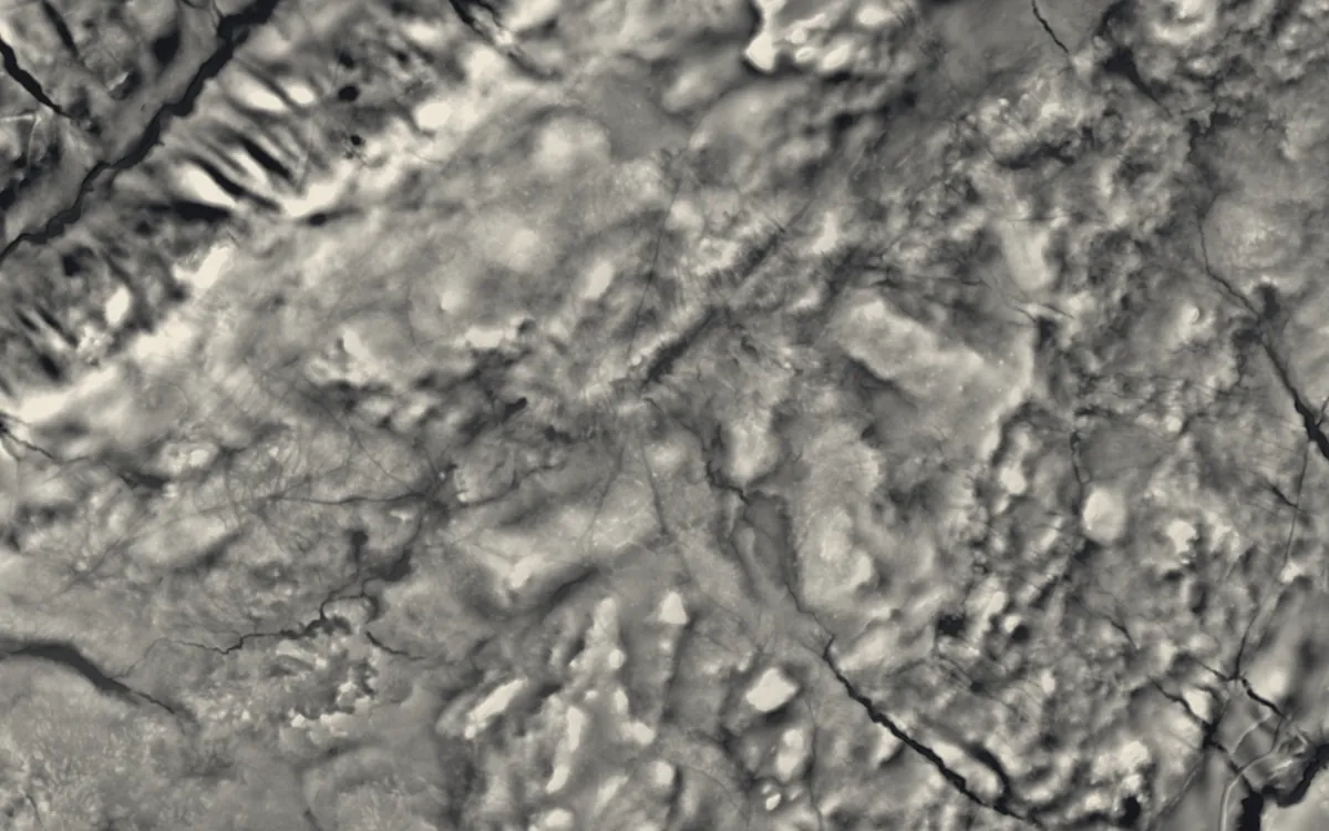 Cairnfield including a prehistoric enclosure, 5 stone circles, 10 funerary cairns, 6 stone banks, 2 stone walls, a lynchet and aCumbria
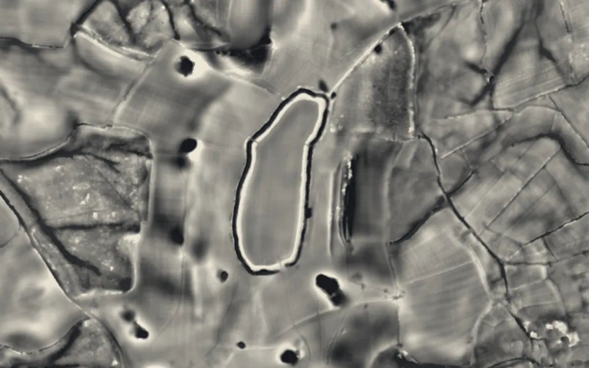 Hillfort and later strip lynchets on Dungeon Hill, 500m north of Castle Hill CottagesDorset
Where they are
Counties with the most lynchets that have a page here.
Sources
- FISH Thesaurus of Monument Types (Historic England): Lynchet
- FISH Thesaurus of Monument Types (Historic England): Strip Lynchet
- FISH Thesaurus of Monument Types (Historic England): Celtic Field System
- Monument Type Thesaurus (Wales), RCAHMW: Lynchet
- Historic England, National Heritage List entry 1019951: Group of medieval strip lynchets at East and West Man
- Historic England, National Heritage List entry 1017302: Medieval strip lynchets 370m south of Greater Lane Farm
- Wikipedia: Lynchet (cross-check)
- Wikipedia: Celtic field (cross-check)
- Relief Visualization Toolbox documentation: Hillshading
Last updated 2026-10-16.