A heritage map of Britain and Ireland

Waystone

Find out what has been recorded on the ground where you are.

Around 850,000 recorded places across Britain and Ireland. The bare-earth shape of the ground across England and Wales. And the instruments archaeologists use to read it — in a browser, free, with nothing to install.

Open the web app
Scroll
The Idea

There are stories everywhere for those with eyes to see.

You walk past history all the time without knowing it.A low rise in a field that was a Roman farm.A parish church with Saxon stone still in its walls.Mounds in the earth that are prehistoric cemeteries. An Iron Age hillfort hidden below the vegetation.

Almost none of it has a signpost. What is known sits scattered across institutional archives, in places nobody would think to look and a search engine will not reach. It is just there, unmarked, while you walk past it. And you are not the first person to look at it.

Free, in any browser.

Open beta · mobile app coming

One place, six layers

Multiple ways to read the landscape.

This is Dorchester in Dorset: Maiden Castle, the largest Iron Age hillfort in Britain, and Durnovaria, the Roman town that succeeded it. Six sources of data cover this ground — a satellite photograph, an airborne laser survey of the ground surface, the Ordnance Survey’s six-inch map of the 1880s, the Roman road network, the aerial archaeology survey, and the national heritage records. Waystone shows all of them over the same ground at once. Scroll to add them one at a time.

Maiden Castle and Durnovaria · Dorchester, Dorset · 50.700° N · 2.462° W Imagery © Esri · LiDAR © Environment Agency, Open Government Licence · 1888 six-inch OS © National Library of Scotland · Aerial mapping © Historic England · Roman roads © Roman Roads Research Association · Recorded places © their record holders
01

Bare-earth LiDAR

Environment Agency · Natural Resources Wales

Airborne laser scanning flown for flood mapping, at one metre per pixel, processed to remove vegetation and buildings. The result is a model of the ground surface on which earthworks show as height. Coverage is England and Wales.

02

Ordnance Survey, 1880s

Six-inch to the mile, 1880s–1900s · National Library of Scotland

The first detailed national survey, drawn by surveyors on the ground. The Library holds the sheets and permits Waystone to use them. Waystone removes the paper colour so the ink can sit over the other layers.

03

The heritage record

National heritage lists · county records · their equivalents across Britain and Ireland

Around 850,000 recorded places, joined and de-duplicated into one map: scheduled monuments, listed buildings, find spots, wrecks. Each pin links back to the record that issued it.

04

Roman roads

Digital Britannia · Roman Roads Research Association

12,339 km of road from the Association’s national survey, used with permission. Each line carries a grade for the evidence behind it, down to a class the compilers call no evidence, requires investigation, drawn as such.

05

Aerial archaeology

Aerial Archaeology Mapping Explorer · Historic England

Features identified on a century of aerial photographs of English fields and mapped by archaeologists, coloured by period, with a separate class for undated features and outlines of the areas the survey has covered.

The LiDAR viewer and its panel

The LiDAR, and the instruments the app reads it with.

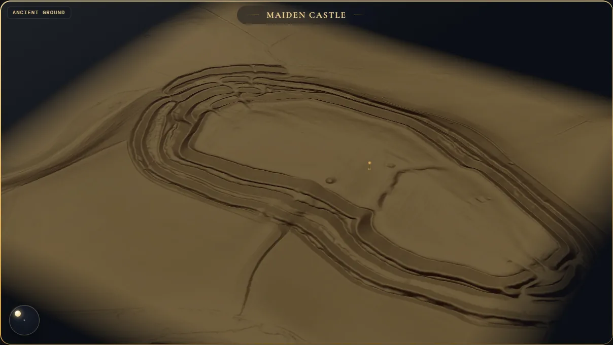
Most online LiDAR viewers show one fixed hillshade. Waystone’s app carries the ground surface itself and computes its readings in the browser as you change the settings. This is Maiden Castle on a 2.5 cm mesh, in the 3D viewer the app uses for its Ancient Ground view. Beside it are five readings the app can take of this ground; choose one, and drag the model to turn it.

Loading the terrain…
Bare earth

MAIDEN CASTLE, DORSET · 50.695° N · 2.470° W · 1.1 KM ACROSS BARE-EARTH TERRAIN · ENVIRONMENT AGENCY LIDAR, OPEN GOVERNMENT LICENCE · PHOTOGRAPH © ESRI

The terrain and its lighting are computed live here. The five Live SLRM radii, the LiDAR/satellite blend, the multidirectional hillshade and the VAT layer are the app’s own renders of this ground at fixed settings; in the app they are computed as the settings change, and they can be stacked. LiDAR coverage is England and Wales; there is no bare-earth layer for Scotland or Ireland yet.

Then read what happened here

Tap a place. Read its true story.

Under the layers are the pins — around 850,000 recorded places across Britain and Ireland, each one traceable to the body that issued it. Tap one and the records come back as something you can actually read, with every source it drew on still attached.

Grimspound on Dartmoor in bare-earth LiDAR, with the tapped pin's card open: the site name, its periods (prehistoric, post medieval), its source at Historic England under the Open Government Licence, and the actions offered.

Every line is gathered from a real record, never invented. Where there is no record, Waystone says nothing.

Explore

Hookney Tor, Grimspound

Hookney Tor is on Dartmoor. The national heritage record classifies it as prehistoric, and in the ground around you are the remains of houses where Bronze Age families lived, cooked and died. These were roundhouses, built of stone and timber, their circular footprints still legible on the moor. Each one held a household.

Hut circles are ordinary. No fortress walls, no ritual monument, no name that survives — just the stone rings where people kept themselves warm on the exposed heights of Dartmoor. The tor above them is a natural landmark, visible for miles. Why families settled here the record does not say.

Can you still see which way the doorways faced?

Was this helpful?
Helpful Not helpful
Sources consulted (3)
Keep exploring What would daily life have looked like inside one of these houses? Why did Bronze Age people choose to live on exposed moorland? What other Bronze Age settlements are visible nearby on Dartmoor?

The Corpus

The librarian, not the expert.

An AI that answers from memory writes fluent, confident history, and some of it is made up. Waystone’s cannot answer from memory. It is the librarian, not the expert: it fetches the real records for the place you tapped, writes from those and nothing else, shows you which ones it read, and says so when they are thin.

One place. One tap. Two very different answers — watch what each system makes of “AI Research.”

Welshbury Hillfort
Prehistoric  ·  Iron Age
2.4 km NE
Historic England · OGL
AI Assistant No sources

Tell me about Welshbury hillfort in the Forest of Dean.

Welshbury is an Iron Age hillfort, built around 600 BC by the Dobunni to watch the iron-ore routes through the forest. Its ramparts enclose roughly six acres, and excavations in the 1950s recovered pottery and querns from the interior.

Who built it, and when exactly?

It was the work of the Dobunni, most likely in the 6th century BC — the tribe who held this stretch of the Severn valley before the Romans arrived.

AI can make mistakes. Consider verifying important information.

Fluent and specific — but not one claim is sourced.

Waystone 3 sources
Welshbury Hillfort
Forest of Dean · Iron Age

Welshbury is a hillfort on a spur above the Flaxley valley, at the eastern edge of the Forest of Dean.1 Historic England’s scheduling describes a single bank and ditch enclosing a roughly trapezoidal area, with two further sets of widely spaced bank and ditch on the south and west sides.1 Its final form matches a developed hillfort of the Middle Iron Age, from about 300 BC.1

The hillfort was built over an earlier field system of lynchets, some standing 4 to 5 m high, which the scheduling dates to at least the Bronze Age.1 More than sixty charcoal-burning platforms lie among the earthworks, most likely from the Forest’s medieval iron industry.1 The Victoria County History records the name in use by 1227 and says the fortifications are thought to have formed an extensive Iron Age fort.2

The Forest of Dean Archaeological Survey, directed by Jon Hoyle for Gloucestershire County Council and published by Historic England, used lidar to map earthworks under the Forest’s woodland.3

Sources consulted (3)
National Heritage List for England — Welshbury hillfort and associated earthworks (1018158)
Historic England · Open Government Licence · Site evidence · Authoritative

The hillfort has been superimposed over an earlier field system comprising lynchets, some of which stand 4m-5m in height, which define both square and rectangular fields.

↗ historicengland.org.uk/listing
A History of the County of Gloucester, volume 5 (1996)
Victoria County History · A P Baggs and A R J Jurica, ‘Flaxley’ · Type & period context

Fortifications on Welshbury, so called by 1227, are thought to have formed an extensive Iron Age fort.

↗ british-history.ac.uk
Forest of Dean Archaeological Survey
Jon Hoyle · Gloucestershire County Council, published by Historic England · Survey report

Passage not yet transcribed — the publisher’s text is not machine-readable.

↗ historicengland.org.uk/images-books

Every line drawn from a real record; where there is no record, Waystone says nothing.

A two-page spread from A History of Staffordshire — Romano-British Staffordshire and its index — digitised for the Waystone corpus
A History of Staffordshire · digitised page from the Waystone library

The library holds what the web doesn’t.

A web search returns web pages. That’s all it can do. Waystone’s library returns passages, not pages: the paragraph that actually mentions your field, out of an excavation report, a county history from the 1800s, a folklore collection out of print for a century — each with its author, its date, its licence and a link straight to the source.

Some of it you could have found yourself, eventually. A great deal of it you could not: eleven thousand of the reports here are archaeological grey literature — written up after a dig, filed, and never published anywhere a search engine was going to hand them to you.

Waystone's Research Library searched for Welshbury: two research reports from Historic England with their authors, dates and Open Government Licence shown, one carrying twelve passages, alongside shelf counts for excavation reports, official records, county histories and folklore, and buttons to export BibTeX or RIS.

Search it yourself.

The Research Library is in the app. 203,888 documents on named shelves — excavation reports, official records, journals, antiquarian societies, county histories, folklore — searchable by title, place or period. Every result names its author, its date and its licence, and exports to BibTeX or RIS.

0 recorded historic places, across Britain and Ireland
0 passages of real heritage writing behind the narrations
0 public archives the data is drawn from, every one credited
Historic England Cadw Coflein Historic Environment Scotland National Monuments Service of Ireland Archaeology Data Service National Library of Scotland Ordnance Survey Environment Agency LiDAR Natural Resources Wales Roman Roads Research Association Wikidata
Walking

Plan a walk between historic places, and see what it passes.

Chysauster is an Iron Age village in west Cornwall: stone courtyard houses about two thousand years old, with walls still standing. Castle-an-Dinas is the hillfort on the hill above it. Ask Waystone for a walk from one to the other and it plans a route on public rights of way, gives the distance, time, climb and grade, and lists every recorded place the route passes, with how far along the walk and how far off the path each one is. The same works between any two points, and any route can be saved or exported as GPX.

Chysauster and Castle-an-Dinas in the app's bare-earth LiDAR reading over the satellite photograph, with its pins and the rights-of-way network
Distance Time Grade Climb

The path network

493,000 rights of way across Great Britain from OpenStreetMap: public footpaths, bridleways, restricted byways and byways open to all traffic, drawn by what you are allowed to do on them, plus every National Trail. Routes are planned on these, not on roads.

Trails on their own switch

National Trails and the cycle network switch on separately from the rights-of-way network, so a cycle route through a town does not clutter a map of footpaths.

Save, export, import

Routes save in the app and export as GPX for a watch or another app. Import a GPX file and the recorded places along it are listed in the same way. Path data © OpenStreetMap contributors, ODbL.

The Roman survey

Roman Britain, with the Roman Roads Research Association.

Mike Haken chairs the Roman Roads Research Association, which he founded with the late Hugh Toller in 2014; it has over 500 members. Digital Britannia is his map of Roman Britain, the Association’s national survey; the Roman Society gave him its Britannia Award in 2026. Every Roman road and site Waystone shows comes from Digital Britannia, with his permission.

The app’s record card for Hardknott: the kicker Fort, the Roman name MEDIOBOGDVM, the periods AD 96–138 and AD 161–211, a Record key, and the credit to Digital Britannia and the Roman Roads Research Association
Hardknott (MEDIOBOGDVM), the fort on Hardknott Pass, Cumbria, in the app, with the Roman road over the pass. Its card is open: AD 96–138 and AD 161–211, and one key, labelled Record, opening Historic England list entry 1009349.Roman roads and sites: Digital Britannia © Mike Haken / Roman Roads Research Association, CC BY-NC 4.0, used with permission · Terrain: Environment Agency National LiDAR Programme, Open Government Licence · Photograph © Esri · Contains Historic England data, Open Government Licence v3.0.

The roads

3,505 segments in the Association’s own cartography: one red throughout, the grade of evidence carried in the line — certain solid, probable dashed, conjectured dotted, none yet pale — and its Margary number. Against a known road it measures within 10 m.

The sites

2,000 Roman sites, each with its Roman name where known, its type, its periods of use, and links to the sources it has: the Historic England list entry, the Heritage Gateway record, a photograph.

Tools

Professional data and professional tools, in one interface anyone can use.

Everything above — national LiDAR, historic Ordnance Survey, the Roman road survey, aerial archaeology mapping, the heritage records and the instruments for reading them — normally lives in desktop GIS behind a download, a licence and training. Waystone puts the same data and instruments in a browser tab, free, for anyone: standard published methods, sources cited, results exported with their settings.

The ground probe open over a rampart at Maiden Castle, reading local relief, sky-view, openness, slope and a grid reference.

Ground probe

Point at the ground and the probe reads the values under the cursor: height, local relief (how far the spot sits above or below its surroundings), sky-view factor, openness, slope, and the National Grid reference. Each figure states its provenance: whether it was baked into the tiles or computed live, at what search radius, from which source.

A cross-section chart cut through the ramparts of Maiden Castle, 364 metres long, showing the ditches and banks in profile.

Cross-section

Tap a start point and an end point and the tool draws the ground profile between them from the LiDAR. This one runs 364 metres across the defences of Maiden Castle; each bank and ditch is visible in the profile. The chart prints its vertical exaggeration, because two profiles are only comparable when that figure matches.

The readings and instruments

Bare-earth relief, sky-view factor, openness, slope and local relief, a live SLRM with the search radius set by you, multi-directional hillshading (every angle, or three lights colouring a slope by its aspect), negative openness for hollows and ditches, and the VAT prospection composite. These are the standard published methods for reading earthworks from LiDAR, computed in the browser.

The data

National LiDAR for England and Wales, the 1880s Ordnance Survey from the National Library of Scotland, the Roman Roads Research Association’s network, Historic England’s aerial archaeology mapping, 21,845 designated boundaries, around 850,000 recorded places, and a library of 200,000 open-licence documents, each with its source and licence attached.

Export with the settings

An image export carries the reading, the shading, the layer mix and the search radius stamped in its corner, so it can be cited and reproduced. Walks export as GPX. Nothing needs installing, and it is free while in beta.

Partners

Working with the National Library of Scotland.

The Library holds the Ordnance Survey’s six-inch first survey of Britain, the map of the 1840s to 1890s that Waystone lays over the ground today. Waystone works with the Library on two pieces of that map.

The hachured ramparts of Maiden Castle on the cream six-inch sheet, left; the same lines in ink over the satellite photograph and the LiDAR relief, right
The six-inch sheet at Maiden Castle as scanned, left, and with the paper taken off, over the LiDAR and the satellite photograph, right. OS six-inch 1st ed. · © National Library of Scotland.

Built

The paper taken off the sheets

Waystone removes the cream paper from the six-inch sheets tile by tile in the browser and keeps the ink, so a sheet can sit over the LiDAR and the satellite photograph, as it does in the field stage above. The method was built for Waystone’s map and for the Library’s own viewer.

Being built

The live relief model

Waystone computes the local relief model from the LiDAR live in the browser: the reading that takes the broad shape of a hill away and leaves the banks, ditches and lynchets on it. It is being built into the Library’s viewer now.

Working with Waystone

Waystone’s tools, data layers and readings can be used outside this site and embedded in another website. Heritage bodies, archives and research groups who want to work with Waystone are welcome to get in touch.

Email Waystone
Research

The research behind the map.

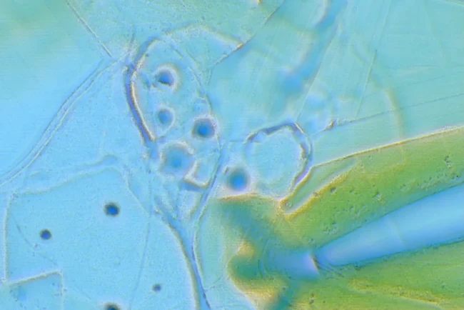
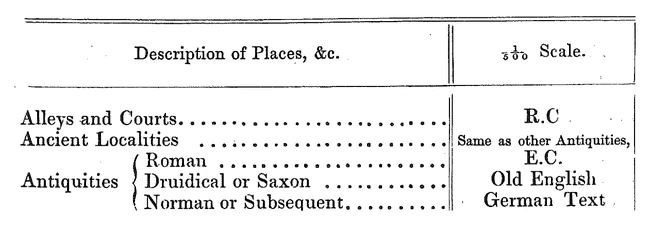
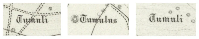
Waystone is also a research project. Two pieces of work are being built: a detector for earthworks in LiDAR, taught by machine learning, and a semantic gazetteer that reads the first Ordnance Survey as data, including the period the surveyor set in the typeface. A third part sets out how the archaeology got onto the map. All three are in progress, and nothing from them is in the app yet.

Terrain: Environment Agency National LiDAR Programme, Open Government Licence. OS 404 (1881) · National Library of Scotland Map X3.234. OS six-inch 1st ed. · © National Library of Scotland.

Read the research
The Maker

A passion project.

Waystone is made and self-funded by me, Matt Bramhall. There is no large company behind it, no team, no investors. It’s a tool I built primarily for myself. Cycling through the British countryside, I’d constantly come across ruins and forgotten places with no easy way to satisfy the questions they raised — what was this, who built it, what happened here. There was nowhere to look it up.

As the project grew, it became clear others felt the same way. The same encounters with places that seemed to have no record and no name anyone still knew. So I decided to open it up.

— Matt Bramhall

More about the project
What’s coming

The road from here.

The data underneath is real. The app around it keeps moving — these are the waypoints, in the order they are actually being walked. Free while it is in beta.

  1. Beta 1 · shipped

    The map and the reader

    The pins, the narration written from real records, and the first Ancient Ground viewer — one hill at a time.

  2. Beta 2 · now

    The layers, nationally

    Bare earth across England and Wales with the instruments live in the browser; the 1888 sheets, the Roman network and the aerial tracings over the same ground; the walking network and a planner; the library, searchable.

  3. Next · built, being tested

    What a place name is telling you

    The Names Layer, Dig Report — whether anyone has ever excavated here — guided walks on the live map rather than a slideshow, the VAT prospection shader, and real scanned stone in the round. In the app already, switched off until they are good enough.

  4. Later

    The Heritage Web

    A map of how places connect — site to site, by shared history, builder, event or story — rather than only by where they happen to sit.


Go and stand in your own field.

Search for where you live. Put the map somewhere ordinary — the paddock behind the estate, the wood at the end of the lane — and switch the LiDAR on. Waystone is in open beta and made by one person; parts of it are rough, and where the record is thin it will say so. Tell me what is wrong and it comes straight to me.

Open Waystone Web

Then go and stand on the thing. That was always the point.