Home Maps by type Stone circles and henges on LiDAR
Stone circles and henges on LiDAR
Neolithic and Bronze Age henges, stone circles and stone rows. Henges show as a circular bank with an inner ditch; many stones are too small for the terrain model, but the banks, settings and nearby barrows show. This list holds the 66 that are scheduled monuments with an article on Wikipedia; the map in the app shows every recorded site.
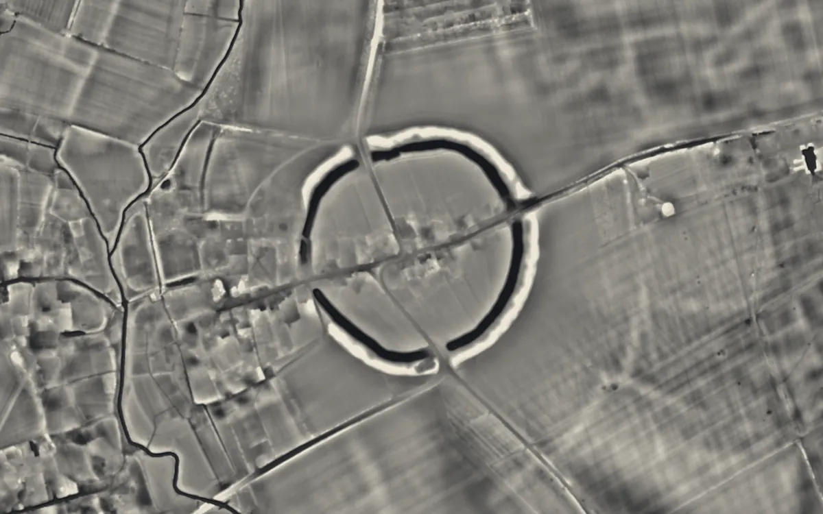
Bedfordshire
Cornwall
- Boskednan stone circle
- Carfury Standing Stone
- Duloe stone circle
- Mên Scryfa
- Mên-an-Tol
- Nine Stones
- The Merry Maidens
- The Pipers
- Tolvan holed stone
Cumbria
- Birkrigg stone circle
- Cairnfield including a prehistoric enclosure, 5 stone circles, 10 funerary cairns, 6 stone banks, 2 stone walls, a lynchet and a
- Castlerigg stone circle
- Elva Plain Stone Circle
- Gamelands stone circle
- Greycroft stone circle
- King Arthur's Round Table
- Long Meg and Her Daughters
- Mayburgh Henge
- Swinside
Denbighshire
Derbyshire
- Arbor Low
- Doll Tor
- Embanked stone circle known as Wet Withens, and adjacent cairn
- Hordron Edge stone circle
- Nine Stones Close
- The Bull Ring
Devon
Dorset
- Maumbury Rings
- Nine Stones
- Rempstone Stone Circle
- The Kingston Russell stone circle 750m north east of Gorwell Farm
East Riding of Yorkshire
Gloucestershire
Isle of Anglesey
Lancashire
Merseyside
North Yorkshire
Northumberland
- Duddo Five Stones
- Standing stone and adjacent round cairn, 760m north east of East Shaftoe Hall
- Stone circle and stone alignment 370m west of Threestoneburn House
- The Goatstones
Oxfordshire
Pembrokeshire
Powys
Shropshire
Somerset
- Drove Cottage Henge
- Porlock Stone Circle
- Stanton Drew stone circles
- Stone circle on Withypool Hill 670m ESE of Portford Bridge
West Yorkshire
Wiltshire
- Avebury
- Coneybury Henge
- Day House Lane Stone Circle
- Falkner's Circle
- Marden Henge
- Stonehenge
- The Longstones
- Winterbourne Bassett Stone Circle
Sources
- LiDAR: Environment Agency; Natural Resources Wales and Welsh Government. Open Government Licence.
- Selection and descriptions: Wikidata (CC0). Records: Historic England, Cadw.
Last updated 2026-10-16.