Home Maps by type Hillforts of England and Wales on LiDAR
Hillforts of England and Wales on LiDAR
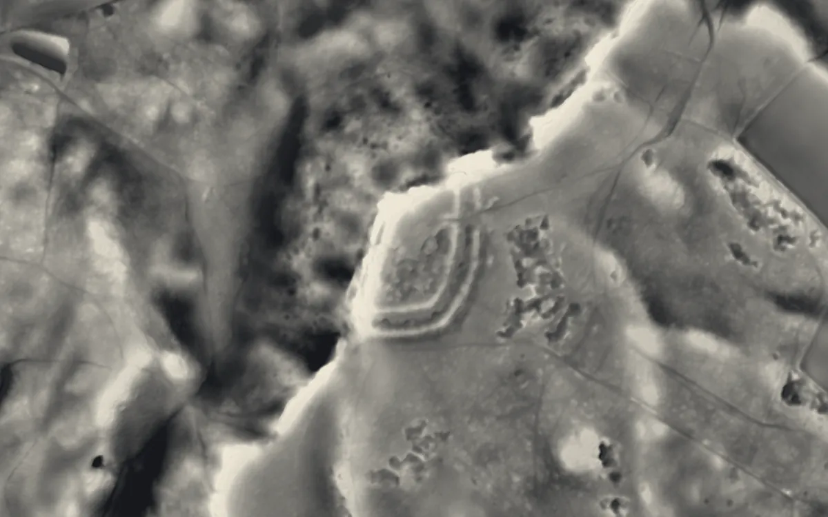
Iron Age and later hillforts: hilltops and promontories enclosed by banks and ditches. Their ramparts survive as earthworks, so they are among the clearest monuments on a LiDAR terrain model, even under woodland. This list holds the 304 that are scheduled monuments with an article on Wikipedia; the map in the app shows every recorded site.
Bedfordshire
Berkshire
Bristol
Buckinghamshire
Caerphilly
Cambridgeshire
Cardiff
Carmarthenshire
Ceredigion
Cheshire
- Bradley hill fort
- Burton Point
- Eddisbury hill fort
- Helsby hill fort
- Kelsborrow Castle
- Maiden Castle
- Oakmere hill fort
- Woodhouse Hill Camp
Conwy
Cornwall
- Black Head
- Cadson Bury
- Castle Dore
- Castle an Dinas, St Columb Major
- Chûn Castle
- Giant's Castle, St Mary's
- Gurnard's Head
- Kelly Rounds
- Largin Castle
- Lescudjack Hill Fort
- Maen Castle
- Padderbury Top
- Prideaux Castle
- St Piran's Round
- The Rumps
- Trencrom Hill
- Treryn Dinas
County Durham
Denbighshire
Devon
- Belbury Castle
- Berry Castle
- Berry's Wood
- Blackbury Camp
- Blackdown Rings
- Boringdon Camp
- Brent Hill
- Cadbury Castle
- Castle Close
- Castle Dyke
- Clovelly Dykes
- Cotley Castle
- Cranbrook Castle
- Cranmore Castle
- Dumpdon Hill
- Greenway Camp
- Hawkesdown Hill
- Hembury
- Hembury Castle
- Hembury Castle, Tythecott
- Holne Chase Castle
- Huntsham Castle
- Knowle Hill Castle
- Membury Castle
- Milber Down
- Musbury Castle
- Posbury
- Prestonbury Castle
- Roborough Castle
- Sidbury Castle
- Slapton Castle
- Smythapark hillfort
- Stanborough Camp
- Stoke Hill
- Voley Castle
- Wasteberry Camp
- Woodbury
- Woodbury Castle
- Wooston Castle
Dorset
- Abbotsbury Castle
- Badbury Rings
- Bindon Hill
- Buzbury Rings
- Coney's Castle
- Dudsbury Camp
- Flower's Barrow
- Hambledon Hill
- Hillfort and later strip lynchets on Dungeon Hill, 500m north of Castle Hill Cottages
- Hillfort on Banbury Hill
- Lambert's Castle
- Maiden Castle
- Poundbury Hill
- Shipton Hill Settlement
- Sturminster Newton Castle
- Woodbury Hill Camp
- Woolsbarrow Hillfort
East Sussex
Essex
Flintshire
Gloucestershire
Greater Manchester
Gwynedd
Hampshire
- Bevisbury
- Buckland Rings
- Bullsdown Camp
- Bury Hill
- Castle Hill
- Chilworth Ring
- Danebury Hill Camp
- Dunwood Camp
- Hillfort on King John's Hill
- Knoll Camp
- Norsebury Ring
- Old Winchester Hill
- Quarley Hill
- St Catherine's Hill
- The Frith
- Tidbury Ring
- Toothill Fort
- Whitsbury Castle
- Woolbury
Herefordshire
- Aconbury Camp
- Bach Camp
- Brandon Camp large univallate hillfort and ring ditch 350m north east of Warwick House.
- Capler Camp
- Croft Ambrey
- Dinedor Camp
- Ivington Camp
- Poston Camp
- Sutton Walls Hill Fort
- Wapley Hill
Hertfordshire
Isle of Anglesey
Kent
Lancashire
Leicestershire
Merthyr Tydfil
Monmouthshire
Neath Port Talbot
Norfolk
North Yorkshire
Northamptonshire
Northumberland
- Clinch Castle
- Defended settlement on Slate Hill, 300m north west of Bolam Lake
- Huckhoe palisaded enclosure, defended settlement and Romano-British settlement, 550m north east of Bolam West Houses
- Prehistoric enclosed settlement, Iron Age hillfort and medieval shielings on Humbleton Hill
Oxfordshire
Pembrokeshire
Powys
- Burfa Castle
- Cefn Carnedd
- Coed-y-Caerau
- Crug Hywel
- Ffridd Faldwyn, Montgomery
- Llwyn Bryn Dinas
- Pentre Camp, Llangyniew
- Roundton Hill
- Slwch Tump
- Tinboeth Castle
Rhondda Cynon Taf
Shropshire
- Bury Ditches
- Bury Walls
- Caer Caradoc
- Caus Castle
- Multiple enclosure hillfort on Coxall Knoll
- Nordy Bank
- Old Oswestry
Somerset
- Banwell Camp
- Bat's Castle
- Berry Castle
- Black Ball Camp
- Blacker's Hill
- Brent Knoll Camp
- Brewer's Castle
- Burledge Hill
- Burrington Camp
- Bury Castle
- Cadbury Camp
- Cadbury Castle
- Cannington Camp
- Castles Camp
- Charterhouse Camp
- Clatworthy Camp
- Cleeve Toot Camp
- Conygar
- Cow Castle
- Creech Hill
- Curdon Wood Camp
- Daw's Castle
- Dinies Camp
- Dolebury Warren
- Dowsborough
- Dundon Hill Hillfort
- East Myne
- Elworthy Barrows
- Grabbist Hill
- Ham Hill
- King's Castle
- King's Castle
- Kingsdown Camp
- Little Solsbury Hill
- Long Wood Enclosure
- Maes Knoll Camp
- Maesbury Castle
- Mounsey Castle
- Multi-period site on Brean Down
- Norton Camp
- Oldberry Castle
- Plainsfield Camp
- Road Castle
- Roddenbury Hillfort
- Ruborough Camp
- Small Down Knoll
- Stantonbury Camp
- Stokeleigh Camp
- Tap's Combe Camp
- Tedbury Camp
- Tunley Camp
- Wadbury Camp
- Wain's Hill
- Westbury Camp
- Whitestaunton Camp
- Worlebury Camp
Staffordshire
Surrey
Swansea
Vale of Glamorgan
West Sussex
- Goosehill Camp
- Harting Beacon: a hilltop enclosure, Anglo-Saxon burial mound and telegraph station on Beacon and Pen Hills
- Thundersbarrow Hill
- Torberry hillfort
- Trundle
West Yorkshire
Wiltshire
- Barbury Castle
- Battlesbury Camp
- Bincknoll Castle
- Bury Camp
- Casterley Camp
- Castle Ditches
- Castle Rings
- Chiselbury
- Clearbury Ring
- Codford Circle
- Figsbury Ring
- Fosbury Camp
- Kenwalch's Castle
- Liddington Castle
- Membury Camp
- Ringsbury Camp
- Scratchbury Camp
- Sidbury Camp
- Vespasian's Camp
- Yarnbury Castle
Worcestershire
Sources
- LiDAR: Environment Agency; Natural Resources Wales and Welsh Government. Open Government Licence.
- Selection and descriptions: Wikidata (CC0). Records: Historic England, Cadw.
Last updated 2026-10-16.