Home Maps by type Castles of England and Wales on LiDAR
Castles of England and Wales on LiDAR
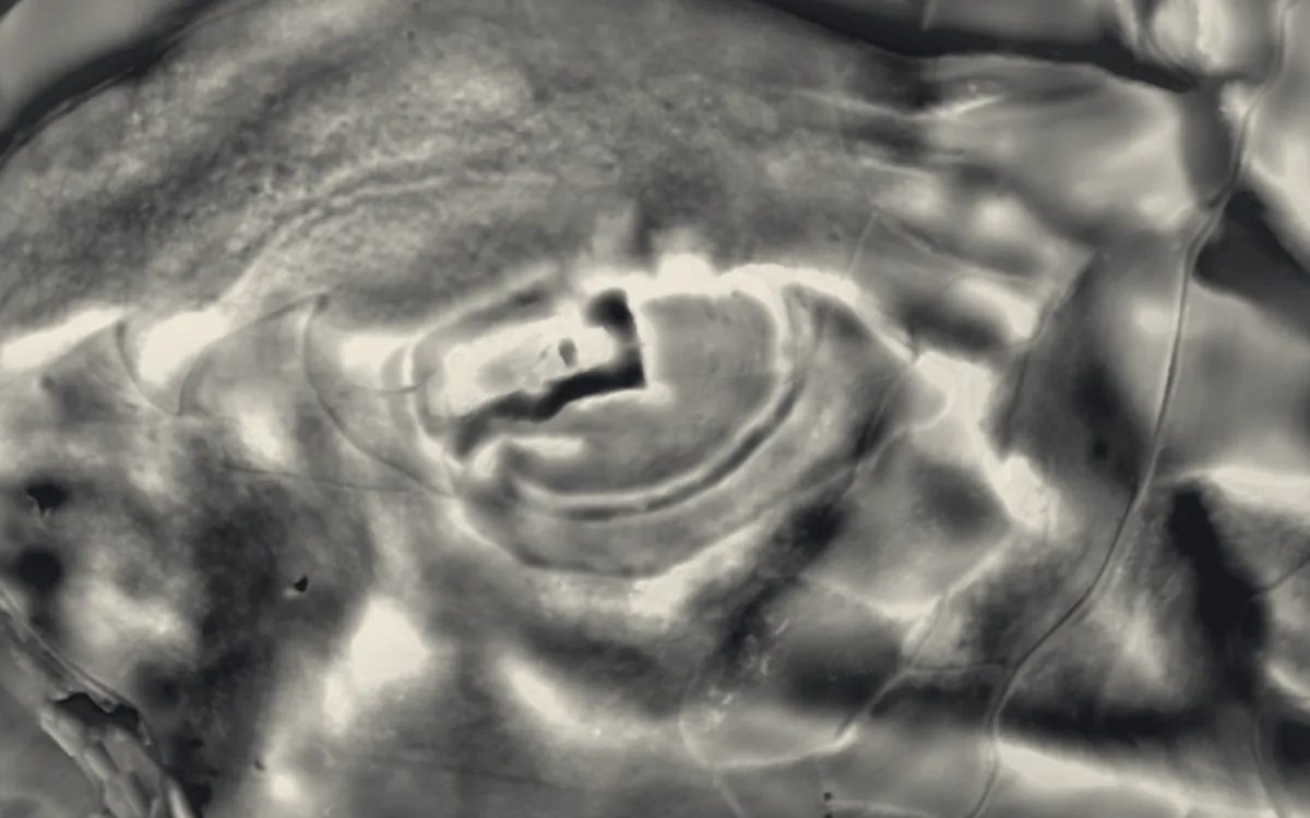
Medieval and later castles that are scheduled monuments. LiDAR shows the earthworks around them: ditches, baileys, fishponds, deer-park banks and the platforms of lost buildings. This list holds the 303 that are scheduled monuments with an article on Wikipedia; the map in the app shows every recorded site.
Bedfordshire
Berkshire
Bridgend
Bristol
Caerphilly
Cambridgeshire
- Buckden Towers
- Burwell Castle
- Cambridge Castle
- Castle Camps
- Cheveley Castle
- Longthorpe Tower
- Peterborough Castle
Cardiff
Carmarthenshire
- Banc y Betws
- Carmarthen Castle
- Carreg Cennen Castle
- Dinefwr Castle
- Kidwelly Castle
- Laugharne Castle
- Newcastle Emlyn Castle
Ceredigion
Cheshire
City of London
Conwy
Cornwall
- Cromwell's Castle
- King Charles's Castle
- Launceston Castle
- Penstowe Castle
- Restormel Castle
- St Catherine's Castle
- St Mawes Castle
County Durham
Cumbria
- Arnside Tower
- Carlisle Castle
- Dalton Castle
- Gleaston Castle
- Hartley Castle
- Millom Castle
- Pendragon Castle
- Piel Castle
- Scaleby Castle
- Triermain Castle
Denbighshire
Derbyshire
Devon
- Bayard's Cove Fort
- Berry Pomeroy Castle
- Dartmouth Castle
- Gidleigh Castle
- Hemyock Castle
- Plymouth Castle
- Plympton Castle
- Rougemont Castle
- Salcombe Castle
- Tiverton Castle
Dorset
East Riding of Yorkshire
East Sussex
Essex
Flintshire
Gloucestershire
Greater London
Greater Manchester
Gwynedd
Hampshire
- Basing House
- Calshot Castle
- Netley Castle
- Odiham Castle
- Portchester Castle
- Southsea Castle
- St Andrew's Castle
- Warblington Castle
- Winchester Castle
- Wolvesey Castle
Herefordshire
- Brampton Bryan Castle
- Bredwardine Castle
- Clifford Castle and Barbican
- Eardisley Castle
- Goodrich Castle
- Hereford Castle
- Huntington Castle
- Longtown Castle
- Mortimer's Castle N and E of St Bartholomew's Church
- Wigmore Castle
- Wilton Castle
Hertfordshire
Isle of Anglesey
Isle of Wight
Kent
- Canterbury Castle
- Cooling Castle
- Deal Castle
- Dover Castle
- Folkestone Castle
- Leybourne Castle
- Queenborough Castle
- Rochester Castle
- Saltwood Castle
- Sandgate Castle
- Sandown Castle
- Sutton Valence Castle
- Tonbridge Castle
- Upnor Castle
- Walmer Castle
- Westenhanger Castle
Lancashire
Leicestershire
Lincolnshire
Monmouthshire
- Abergavenny Castle
- Caldicot Castle
- Castell Arnallt
- Chepstow Castle
- Grosmont Castle
- Llangibby Castle
- Monmouth Castle
- Monnow Bridge
- Raglan Castle
- Skenfrith Castle
- White Castle
Neath Port Talbot
Newport
Norfolk
- Baconsthorpe Castle
- Buckenham Castle
- Caister Castle
- Castle Rising Castle
- Claxton Castle
- Gresham Castle
- Horsford Castle
North Yorkshire
- Bolton Castle
- Cawood Castle
- Danby Castle
- Harlsey Castle
- Helmsley Castle
- John O'Gaunt's Castle
- Kilton Castle
- Knaresborough Castle
- Middleham Castle
- Ravensworth Castle
- Richmond Castle
- Scarborough Castle
- Sheriff Hutton Castle
- Slingsby Castle
- Upsall Castle
- Whorlton Castle
Northamptonshire
Northumberland
- Cresswell Castle
- Dilston Castle
- Dunstanburgh Castle
- Edlingham Castle
- Etal Castle
- Morpeth Castle
- Prudhoe Castle
- Thirlwall Castle
- Whitley Castle
- Widdrington Castle
Nottinghamshire
Oxfordshire
Pembrokeshire
- Carew Castle
- Cilgerran Castle
- Cresswell Castle
- Haverfordwest Castle
- Llawhaden Castle
- Manorbier Castle
- Narberth Castle
- Pembroke Castle
- Tenby Castle
Powys
- Aberedw Castle
- Aberyscir Castle
- Blaenllyfni Castle
- Brecon Castle
- Bronllys Castle
- Builth Castle
- Castell Dinas
- Castell Du
- Cefnllys Castle
- Crickhowell Castle
- Dolforwyn Castle
- Hay Castle
- Mathrafal
- Montgomery Castle
- Rhayader Castle
- Tretower Castle
Rhondda Cynon Taf
Shropshire
- Alberbury Castle
- Bridgnorth Castle
- Hopton Castle
- Ludlow Castle
- Moreton Corbet Castle
- Shrewsbury Castle
- Stokesay Castle
- Whittington Castle
Somerset
South Yorkshire
Staffordshire
Suffolk
Surrey
Swansea
Tyne & Wear
Vale of Glamorgan
Warwickshire
West Midlands
West Sussex
West Yorkshire
Wiltshire
Worcestershire
Wrexham
Sources
- LiDAR: Environment Agency; Natural Resources Wales and Welsh Government. Open Government Licence.
- Selection and descriptions: Wikidata (CC0). Records: Historic England, Cadw.
Last updated 2026-10-16.