Home LiDAR map England Northumberland
LiDAR map of Northumberland
Waystone shows the bare-earth LiDAR of Northumberland at one metre per pixel, with the 6,656 recorded historic places the heritage records hold here, the Roman roads and the Ordnance Survey six-inch maps of 1843–1913 over the same ground. Free, in a browser.
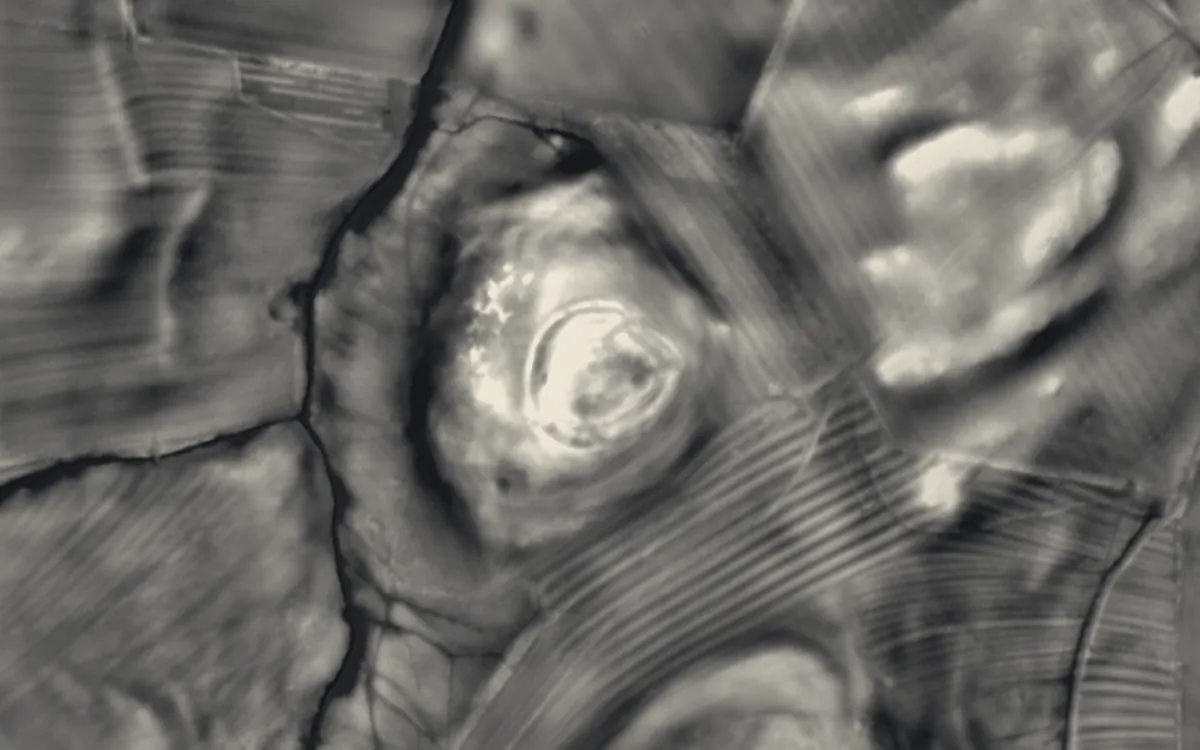
Places on the LiDAR in Northumberland
Each page shows the site on the LiDAR with its record, its location and the recorded places around it.
- AesicaRoman fort
- Alnwick AbbeyAbbey
- Aydon CastleFortified manor house
- Berwick BridgeBridge
- Biddlestone RC ChapelChapel or church
- Blanchland AbbeyAbbey
- Bondgate TowerScheduled monument
- BremeniumRoman fort
- Brinkburn PrioryPriory
- Chollerford BridgeBridge
- Clinch CastleHillfort
- Corbridge BridgeBridge
- CoriaRoman fort
- Cresswell CastleCastle
- Defended settlement on Slate Hill, 300m north west of Bolam LakeHillfort
- Devil's Lapful Long Cairn, 1km east of Butteryhaugh BridgeScheduled monument
- Dilston CastleCastle
- Duddo Five StonesStone circle
- Duddo TowerScheduled monument
- Dunstanburgh CastleCastle
- Edlingham CastleCastle
- Elsdon CastleMotte and bailey
- Etal CastleCastle
- HabitancumRoman fort
- Hexham AbbeyAbbey
- Hexham BridgeBridge
- Hexham Old GaolScheduled monument
- Huckhoe palisaded enclosure, defended settlement and Romano-British settlement, 550m north east of Bolam West HousesHillfort
- Hulne PrioryPriory
- HunnumRoman fort
- Kielder ViaductBridge
- Lees Hall Roman campScheduled monument
- Mitford CastleMotte and bailey
- Morpeth CastleCastle
- Morpeth Clock TowerScheduled monument
- Motte and bailey castle on Haw HillMotte and bailey
- Newminster AbbeyAbbey
- Old Haydon BridgeBridge
- Prehistoric enclosed settlement, Iron Age hillfort and medieval shielings on Humbleton HillHillfort
- Preston TowerScheduled monument
- Prudhoe CastleCastle
- Romano-British settlement and Iron Age defended settlement, 550m north east of Shaftoe GrangeScheduled monument
- Standing stone and adjacent round cairn, 760m north east of East Shaftoe HallStone circle
- Stone circle and stone alignment 370m west of Threestoneburn HouseStone circle
- The GoatstonesStone circle
- The Vicars PeleScheduled monument
- Thirlwall CastleCastle
- Twizel BridgeBridge
- Wark on Tweed CastleMotte and bailey
- Warkworth CastleMotte and bailey
- Warkworth HermitageScheduled monument
- Whitley CastleCastle
- Widdrington CastleCastle
LiDAR maps of the parishes of Northumberland
One page for each of the 164 parishes, with a LiDAR picture and the recorded places inside it.
- Acklington23 recorded places
- Acomb23 recorded places
- Adderstone with Lucker22 recorded places
- Akeld77 recorded places
- Allendale60 recorded places
- Alnham25 recorded places
- Alnmouth36 recorded places
- Alnwick70 recorded places
- Alwinton64 recorded places
- Amble by the Sea29 recorded places
- Ancroft43 recorded places
- Ashington40 recorded places
- Bamburgh56 recorded places
- Bardon Mill162 recorded places
- Bavington19 recorded places
- Beadnell28 recorded places
- Belford41 recorded places
- Bellingham32 recorded places
- Belsay96 recorded places
- Berwick-upon-Tweed156 recorded places
- Bewick34 recorded places
- Biddlestone15 recorded places
- Birtley20 recorded places
- Blanchland14 recorded places
- Blyth80 recorded places
- Bowsden3 recorded places
- Branxton12 recorded places
- Brinkburn15 recorded places
- Broomhaugh and Riding17 recorded places
- Bywell26 recorded places
- Callaly20 recorded places
- Capheaton22 recorded places
- Carham62 recorded places
- Chatton81 recorded places
- Chillingham31 recorded places
- Chollerton55 recorded places
- Choppington21 recorded places
- Coanwood10 recorded places
- Corbridge89 recorded places
- Cornhill-on-Tweed42 recorded places
- Corsenside68 recorded places
- Cramlington59 recorded places
- Craster24 recorded places
- Cresswell48 recorded places
- Denwick37 recorded places
- Doddington22 recorded places
- Duddo33 recorded places
- Earle38 recorded places
- East Bedlington44 recorded places
- East Chevington26 recorded places
- Edlingham41 recorded places
- Eglingham37 recorded places
- Ellingham12 recorded places
- Ellington and Linton10 recorded places
- Elsdon24 recorded places
- Embleton21 recorded places
- Ewart17 recorded places
- Falstone16 recorded places
- Featherstone15 recorded places
- Felton20 recorded places
- Ford64 recorded places
- Glanton11 recorded places
- Greenhead150 recorded places
- Greystead12 recorded places
- Haltwhistle89 recorded places
- Harbottle32 recorded places
- Hartburn44 recorded places
- Hartleyburn9 recorded places
- Hauxley25 recorded places
- Haydon76 recorded places
- Healey7 recorded places
- Hebron19 recorded places
- Heddon-on-the-Wall56 recorded places
- Hedgeley56 recorded places
- Hedley18 recorded places
- Henshaw100 recorded places
- Hepple23 recorded places
- Hepscott24 recorded places
- Hesleyhurst5 recorded places
- Hexham66 recorded places
- Hexhamshire36 recorded places
- Hollinghill11 recorded places
- Holy Island20 recorded places
- Horncliffe20 recorded places
- Horsley28 recorded places
- Humshaugh57 recorded places
- Ilderton102 recorded places
- Ingram101 recorded places
- Kielder29 recorded places
- Kilham62 recorded places
- Kirknewton262 recorded places
- Kirkwhelpington36 recorded places
- Knaresdale with Kirkhaugh82 recorded places
- Kyloe32 recorded places
- Lesbury21 recorded places
- Lilburn16 recorded places
- Longframlington17 recorded places
- Longhirst20 recorded places
- Longhorsley8 recorded places
- Longhoughton62 recorded places
- Lowick23 recorded places
- Lynemouth2 recorded places
- Matfen34 recorded places
- Meldon20 recorded places
- Melkridge47 recorded places
- Middleton17 recorded places
- Milfield8 recorded places
- Mitford44 recorded places
- Morpeth56 recorded places
- Netherton5 recorded places
- Netherwitton19 recorded places
- Newbiggin by the Sea37 recorded places
- Newbrough95 recorded places
- Newton-by-the-Sea23 recorded places
- Newton-on-the-Moor and Swarland17 recorded places
- Norham61 recorded places
- North Sunderland25 recorded places
- Nunnykirk10 recorded places
- Ord16 recorded places
- Otterburn34 recorded places
- Ovingham12 recorded places
- Ovington2 recorded places
- Pegswood19 recorded places
- Plenmeller with Whitfield28 recorded places
- Ponteland43 recorded places
- Prudhoe16 recorded places
- Rennington15 recorded places
- Rochester175 recorded places
- Roddam7 recorded places
- Rothbury49 recorded places
- Rothley12 recorded places
- Sandhoe12 recorded places
- Seaton Valley155 recorded places
- Shilbottle7 recorded places
- Shoreswood9 recorded places
- Shotley Low Quarter37 recorded places
- Simonburn111 recorded places
- Slaley19 recorded places
- Snitter3 recorded places
- Stamfordham62 recorded places
- Stannington59 recorded places
- Stocksfield28 recorded places
- Tarset18 recorded places
- Thirlwall40 recorded places
- Thirston13 recorded places
- Thropton17 recorded places
- Togston9 recorded places
- Tritlington and West Chevington19 recorded places
- Ulgham12 recorded places
- Wall65 recorded places
- Wallington Demesne35 recorded places
- Warden39 recorded places
- Wark28 recorded places
- Warkworth57 recorded places
- West Allen67 recorded places
- West Bedlington46 recorded places
- Whalton21 recorded places
- Whittingham39 recorded places
- Whittington50 recorded places
- Whitton and Tosson24 recorded places
- Widdrington Station and Stobswood7 recorded places
- Widdrington Village112 recorded places
- Wooler74 recorded places
- Wylam21 recorded places
About the LiDAR
The terrain model is made from an airborne laser survey with vegetation and buildings removed, so earthworks show as height: hillfort ramparts, barrows, Roman road banks, hollow ways and ridge and furrow. In the app the picture is computed as you change the settings, with a moveable sun, a local relief model, multidirectional hillshading and the VAT composite. See how to read a LiDAR map and what archaeology looks like on LiDAR.
Sources
- LiDAR: Environment Agency, 1 m composite DTM, Open Government Licence.
- Recorded places: the national heritage records (Historic England, Cadw, Coflein and others) as held by Waystone.
Last updated 2026-10-16.