Home LiDAR map Wales Ceredigion
LiDAR map of Ceredigion
Waystone shows the bare-earth LiDAR of Ceredigion at one metre per pixel, with the 4,524 recorded historic places the heritage records hold here, the Roman roads and the Ordnance Survey six-inch maps of 1843–1913 over the same ground. Free, in a browser.
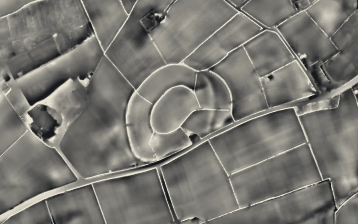
Places on the LiDAR in Ceredigion
Each page shows the site on the LiDAR with its record, its location and the recorded places around it.
- Aberdyfi CastleMotte and bailey
- Bedd TaliesinBarrow
- Cardigan CastleCastle
- Castell GwallterCastle
- Castell NadoligHillfort
- Dinerth CastleCastle
- Dyfi FurnaceIndustrial site
- Frongoch MineIndustrial site
- Gaer FawrHillfort
- Hen Gaer, Bow StreetHillfort
- Lampeter CastleMotte and bailey
- Llywernog MineIndustrial site
- Strata Florida AbbeyAbbey
- Ystrad PeithyllMotte and bailey
LiDAR maps of the communities of Ceredigion
One page for each of the 51 communities, with a LiDAR picture and the recorded places inside it.
- Aberaeron60 recorded places
- Aberporth47 recorded places
- Aberystwyth109 recorded places
- Beulah86 recorded places
- Blaenrheidol755 recorded places
- Borth78 recorded places
- Cardigan50 recorded places
- Ceulanamaesmawr140 recorded places
- Ciliau Aeron39 recorded places
- Dyffryn Arth36 recorded places
- Faenor24 recorded places
- Geneu'r Glyn35 recorded places
- Henfynyw27 recorded places
- Lampeter51 recorded places
- Llanarth42 recorded places
- Llanbadarn Fawr28 recorded places
- Llanddewi Brefi305 recorded places
- Llandyfriog53 recorded places
- Llandysiliogogo46 recorded places
- Llandysul84 recorded places
- Llanfair Clydogau49 recorded places
- Llanfarian63 recorded places
- Llanfihangel Ystrad56 recorded places
- Llangeitho33 recorded places
- Llangoedmor53 recorded places
- Llangrannog34 recorded places
- Llangwyryfon25 recorded places
- Llangybi37 recorded places
- Llangynfelyn73 recorded places
- Llanilar31 recorded places
- Llanllwchaiarn19 recorded places
- Llanrhystyd51 recorded places
- Llansantffraed28 recorded places
- Llanwenog32 recorded places
- Llanwnnen28 recorded places
- Lledrod45 recorded places
- Melindwr149 recorded places
- Nantcwnlle29 recorded places
- New Quay19 recorded places
- Penbryn52 recorded places
- Pontarfynach109 recorded places
- Tirymynach46 recorded places
- Trawsgoed100 recorded places
- Trefeurig88 recorded places
- Tregaron129 recorded places
- Troedyraur48 recorded places
- Y Ferwig58 recorded places
- Ysbyty Ystwyth315 recorded places
- Ysgubor-y-coed84 recorded places
- Ystrad Fflur484 recorded places
- Ystrad Meurig49 recorded places
About the LiDAR
The terrain model is made from an airborne laser survey with vegetation and buildings removed, so earthworks show as height: hillfort ramparts, barrows, Roman road banks, hollow ways and ridge and furrow. In the app the picture is computed as you change the settings, with a moveable sun, a local relief model, multidirectional hillshading and the VAT composite. See how to read a LiDAR map and what archaeology looks like on LiDAR.
Sources
- LiDAR: Natural Resources Wales and Welsh Government, 1 m DTM, Open Government Licence.
- Recorded places: the national heritage records (Historic England, Cadw, Coflein and others) as held by Waystone.
Last updated 2026-10-16.